
SOUTH-CENTRAL, Ind. - The National Weather Service (NWS) in Indianapolis has issued a Flood Watch for most of Central, South-Central, and Southeastern Indiana from 7 p.m. on Tuesday through Wednesday at 10 a.m.
Due to the continuing rain, flooding is possible in Bartholomew, Johnson, Jackson, Jennings, Brown, Shelby, Decatur, and Marion Counties.
Excessive runoff may result in flooding of rivers, creeks, streams, and other low-lying/flood-prone locations. Creeks and streams may rise out of their banks.
NWS says rainfall amounts through Wednesday morning are expected to generally be between 2 and 3 inches, with the potential for locally higher amounts.
 Crump Theatre receives over $6M grant
 JNET allegedly recovers handgun, meth during traffic stop; North Vernon man arrested
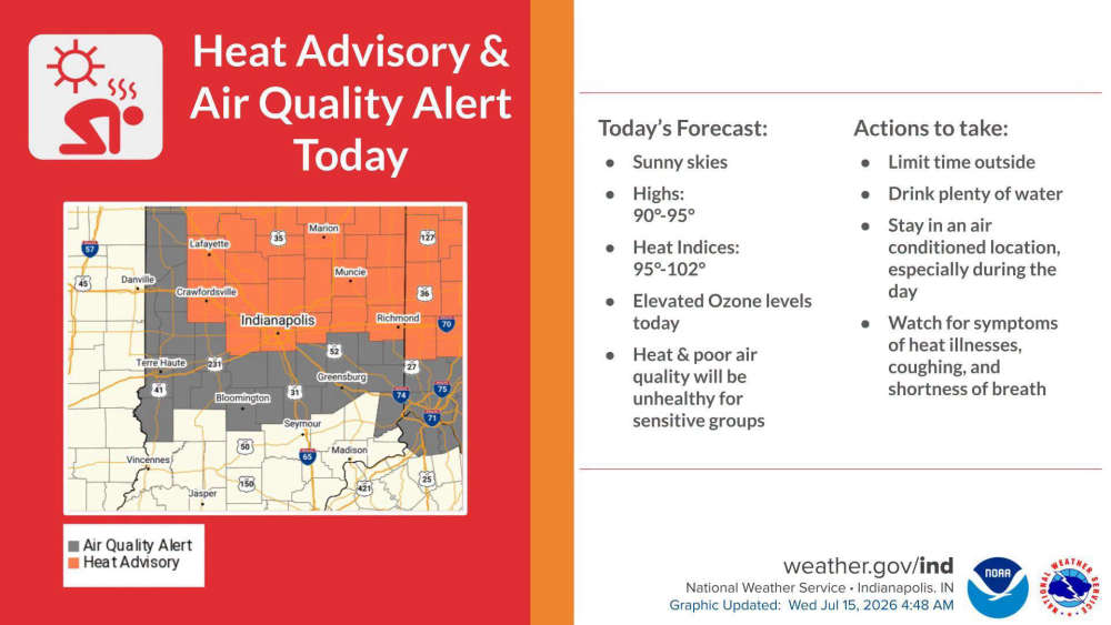 Air Quality Alert declared for South-Central Indiana until late Wednesday
 Edinburgh, German Township Fire crews respond to semi fire on I-65
 Hotter temperatures expected this week
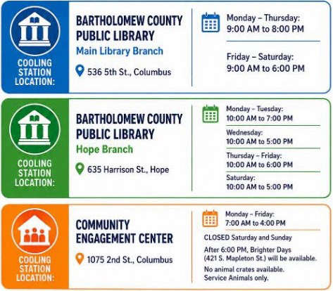 Bartholomew County Cooling Stations open to beat the heat
 Columbus Fire Department hires six firefighters
 Indiana BMV approves retro license plates

