
SOUTH-CENTRAL, Ind. - The National Weather Service says the Winter Storm Warning ends at 7 a.m. today. However, an Extreme Cold Warning is in effect for Bartholomew, Johnson, Jackson, Jennings, Brown, Decatur, and Shelby Counties from Monday at 7 p.m. until Tuesday at 7 a.m.
The Travel status for all of south-central Indiana remains at the RED Warning level. Roads are still snow-covered and hazardous for travel.
Snow accumulation amounts for the area have ranged from 12 to 18 inches. Blowing and drifting will continue Monday with wind speeds of 20-25 mph. High temperatures this week will be in the single digits to teens, with wind chills falling to -20 at times.
With the dangerously cold temperatures, dress in layers if you have to go outside and limit your time outdoors. Protect your pipes from freezing by opening cabinet doors that are around plumbing.
Find road conditions using the INDOT Trafficwise map. Check statewide travel advisories here.
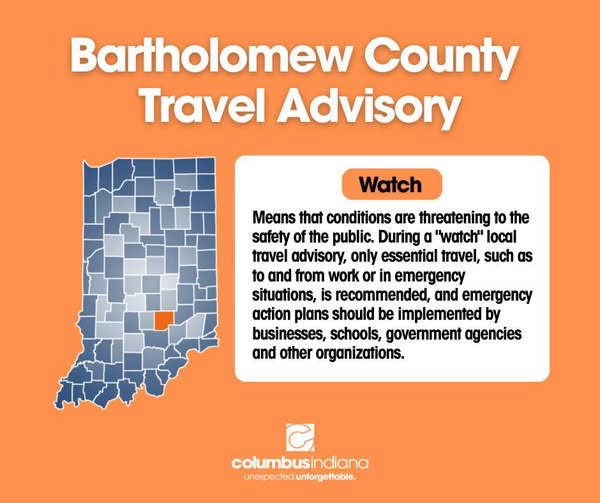 Bartholomew County Travel Status downgraded to 'Orange'
 Hendricks named Associate Director of Recreation at Columbus Parks and Rec
 School and other closings for Tuesday are rolling in
 City of Columbus, Bartholomew County buildings closed Tuesday; essential personnel will report to work
 Extreme Cold Warning in effect until 9 a.m. Tuesday
 Bartholomew County remains under 'Red' Travel Advisory, officials will reevaluate Tuesday
 Non-urgent procedures at CRH postponed on Monday; All emergency services are open
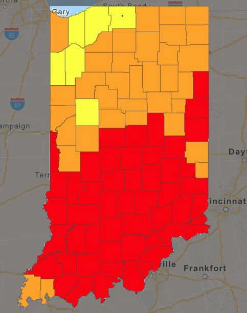 Travel Warning (RED level) is in effect for all area counties
