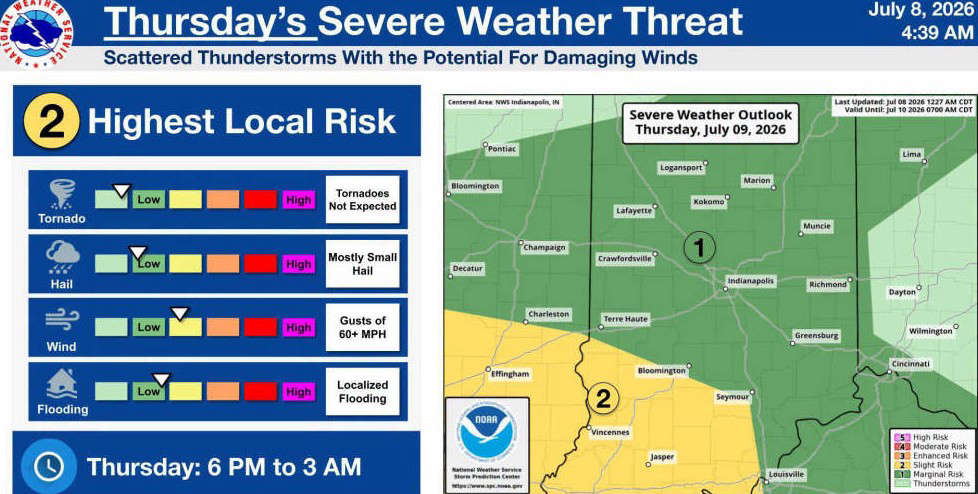
INDIANAPOLIS - The National Weather Service in Indianapolis is forecasting the potential for strong to severe thunderstorms across south-central Indiana on Thursday evening, July 9, into early Friday morning, July 10.
Bartholomew, Johnson, Jackson, Jennings, Decatur, Brown, and Shelby Counties are currently under a Marginal Risk (Level 1 of 5) for severe weather late Thursday into early Friday (6 p.m. to 3 a.m.).
Scattered thunderstorms are expected to develop during the evening and overnight hours. While widespread severe weather is not anticipated, the NWS says a few storms could become severe.
Thursday hazards include:
- Damaging wind gusts over 60 mph (primary threat)
- Small hail
- Localized flooding from heavy rainfall
- Tornadoes are not expected at this time
 10 East/North students selected as 2027 Lilly Scholarship finalists
 Vote early at Gather Columbus, Bartholomew Co. Office Bldg.
 Edinburgh town council approves $10.4M budget for 2027
 Whiteland Fall Fest is Friday evening
 Greenwood Sports Park sets major youth baseball, softball tournament schedule