COLUMBUS, Ind.- The National Weather Service (NWS) issued a warning that a potent storm system is possible in Bartholomew County on Thursday night with a chance of strong to severe storms between 2 and 10 p.m.
Isolated to scattered thunderstorms are possible, with large hail as the primary early threat.
Bartholomew County has now been upgraded to an Enhanced Risk for severe weather later today.
Timing:
- Storms are possible from 1 to 10 p.m.
- Most likely timeframe is 3 to 7 p.m.
- There is still some uncertainty regarding the exact time of storm initiation
Main Hazards:
- Damaging straight-line winds at 60+ mph
- Large hail the size of 1 inch or more
- Tornadoes are possible
What You Should Do:
- Stay weather-aware throughout the day
- Have multiple ways to receive warnings (NOAA Weather Radio, phone alerts, local media)
- Secure outdoor items that could be blown around
- Know your safe place - the lowest level, interior room away from windows
 Crump Theatre receives over $6M grant
 JNET allegedly recovers handgun, meth during traffic stop; North Vernon man arrested
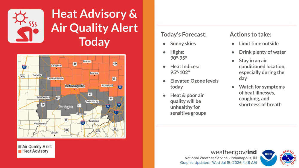 Air Quality Alert declared for South-Central Indiana until late Wednesday
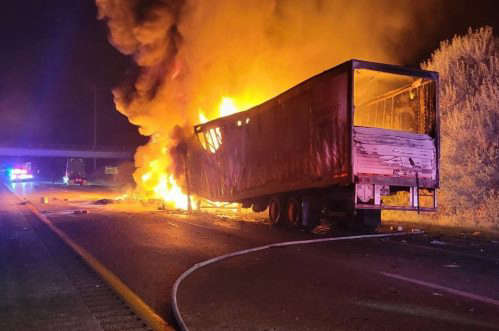 Edinburgh, German Township Fire crews respond to semi fire on I-65
 Hotter temperatures expected this week


