SOUTH-CENTRAL, Ind. -The National Weather Service (NWS) advises that South-Central Indiana will experience two rounds of severe weather on Monday, July 27 into Tuesday, July 28.
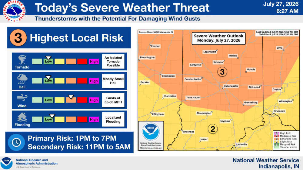
South-Central Indiana will be under an 'enhanced risk'(3 out of 5) for severe weather that will move through between 1 p.m, and 7 p.m. and bring a primary threat for damaging winds. The second overnight round of severe weather is less certain at this time.
According to Bartholomew County Emergency Management, Bartholomew County is under an active weather pattern today through tonight, with the potential for strong to severe thunderstorms.
- Enhanced Risk (Level 3 of 5): Northeastern half of Bartholomew County
- Slight Risk (Level 2 of 5): Southwestern half of Bartholomew County
Timing
- Primary Threat: 1:00 PM – 7:00 PM
- Secondary Threat: 11:00 PM – 5:00 AM
Potential Hazards
- Damaging wind gusts of 60–80 MPH (primary threat)
- Isolated tornadoes
- Small hail
- Localized flooding from heavy rainfall
Forecast confidence remains low regarding the exact timing and location of storm development, but atmospheric conditions will be favorable for severe thunderstorms. The greatest confidence for organized storms is during the afternoon and early evening, with another round of storms possible overnight.
For more information, visit the National Weather Service website here
 10 East/North students selected as 2027 Lilly Scholarship finalists
 Vote early at Gather Columbus, Bartholomew Co. Office Bldg.
 Edinburgh town council approves $10.4M budget for 2027
 Whiteland Fall Fest is Friday evening
 Greenwood Sports Park sets major youth baseball, softball tournament schedule