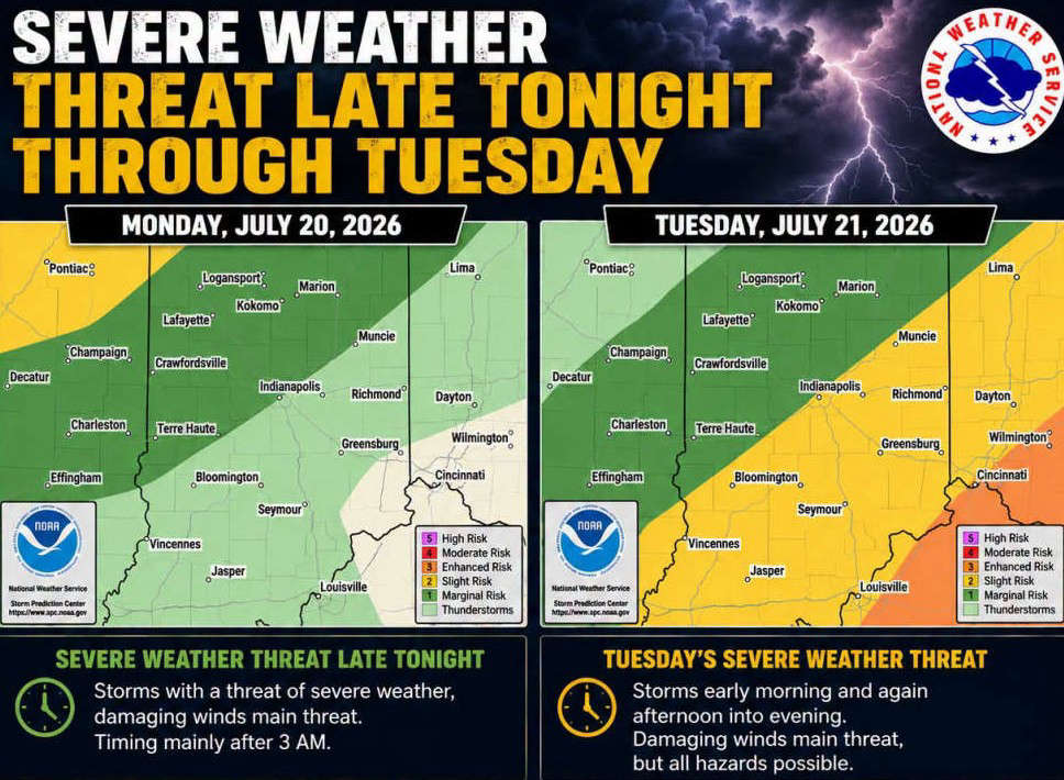
SOUTH-CENTRAL, Ind.- The National Weather Service (NWS) is forecasting multiple rounds of possible thunderstorms across south-central Indiana beginning late Monday night, July 20, and continuing through Tuesday evening, July 21. An air quality alert has also been issued through 11:59 p.m. on Monday.
Showers and thunderstorms are expected to move into the area late Monday night/early Tuesday morning. A few storms could become severe, with damaging wind gusts as the primary hazard.
More thunderstorms may continue through the morning hours of Tuesday before a brief lull is possible. On Tuesday afternoon and evening, Bartholomew and surrounding Counties have been placed under a Slight Risk (Level 2 of 5) for severe weather. NWS says another round of thunderstorms is expected to develop on Tuesday afternoon and evening.
Damaging winds will remain the primary threat, but all severe weather hazards are possible, including:
- Damaging wind gusts
- Large hail
- Isolated tornadoes
- Heavy rainfall
 10 East/North students selected as 2027 Lilly Scholarship finalists
 Vote early at Gather Columbus, Bartholomew Co. Office Bldg.
 Edinburgh town council approves $10.4M budget for 2027
 Whiteland Fall Fest is Friday evening
 Greenwood Sports Park sets major youth baseball, softball tournament schedule